|
|
|
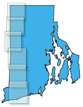
 Click on a panel at right |
 |
| Scanned from the Rhode Island Greenways Map, provided for free distribution by the Rhode Island Greenways Council, One Capitol Hill, Providence, RI 02908. |
 |
MAPS COVER THE ENTIRE TRAIL IN THE FOLLOWING SECTIONS (SOUTH TO NORTH): Map 1 Charlestown-RichmondFrom Blue Shutters Beach to Carolina Management Area Map 2 Richmond-Exeter From Wood River Junction to Arcadia Management Area Map 3 Exeter-Coventry From Browning Mill Pond to Carbuncle Pond Map 4 Coventry-Foster From Carbuncle Pond to Route 6 Map 5 Foster-Glocester From Route 6 to Bowdish Reservoir Map 6 Glocester-Burrillville From Bowdish Reservoir to the Massachusetts line |
||
These six JPEG images range from 106 to 132 kb. That's pretty big by WWW standards. With a typical modem connection, it could take a minute or two to download one of these maps to your computer screen. (Users of cable modems, T1 lines, etc. may experience a fleeting moment of nostalgia.) |
|
Go to The Unofficial Guide to the North South Trail home page |
Go to Outdoors at htmlplanet index page |
|
| All
opinions, idiosyncracies and perceptions of fact are products of The ekent Opinion
Factory. No warranty is expressed or implied. Any injury incurred during their use is the
sole responsibility of the consumer. |